

Causeway Coast and Glens Heritage Trust (CCGHT) focused the case study on Rathlin Island, following consultation by online meeting, phone call and day to day work with the community via the Rathlin Island Development Community Association (RDCA).
Rathlin Island is Northern Ireland’s only inhabited island, lying 6 miles off its north coast. The L-shaped Island is 4 miles east to west and 2.5 miles north to south. The underlying geology makes the island visually striking as a white limestone base layer sits below contrasting, dark basalt layers. The Islands landscape is one of undulating hills and grassland running to steep rugged cliff edges forming high headlands with crashing waters below. Land sweeps down to the sea at Church Bay providing the main access point and settlement on the island.
Rathlin Island is home to some 160 permanent residents, across 70 households and is thought to have been inhabited for over 1,500 years. People working and living on the island have shaped it, evidenced by buildings, land workings and signs of industry along the coastline and inland.
Two ferries operate from Ballycastle, the nearest town, brining residents, supplies and approximately 40,000 visitors per year. Most visit the RSPBs Seabird Centre, where a spectacular array of Atlantic Puffins can be seen. Private sailings, commercial fishing and seaweed harvesting operate in the surrounding waters.
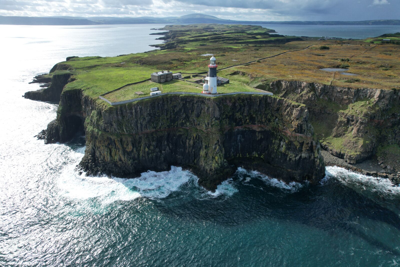
The ties to sealife are clear, with three lighthouses on the Island; East Lighthouse, West Light house and Rue Lighthouse.
The community are represented by Rathlin Island Development Community Association (RDCA). CCGHT work closely with RDCA including on this case study.
Rathlin Island benefits from its own NI Executive Policy and associated Action Plan, guiding Departments, Local Authorities and partners such as CCGHT to work together to realise benefits for the Island and its community. Along with numerous building and environmental designations the island is recognised as part of the Antrim Coast and Glens Area of Outstanding Natural Beaty; acknowledging the quality of the landscape. However, this rural community face many challenges similar of other areas in the NPA. Unique coastal heritage goes unmonitored and underrepresented with tangible and intangible heritage connections lost over generations or to the harsh coastal elements.
To address this CCGHT undertook the COAST project, choosing Rathlin Island as the case study location. As RDCA represent the community they formed the main contact point however throughout individual residents were engaged in conversation, updated via neighbour newsletter and invited to take part in training and activities. Due to COVID-19 it was necessary to operate virtually with site visits, training and field work prioritised for in-person visits.
Following consultation with the community it was agreed that records of the coastlines natural and built heritage were needed, upon which the layers of cultural history could be documented. To ensure the community had capacity to document their island and heritage three residents were trained and certified by CAA as drone pilots. Furthermore, two locations where identified to start this digital record collection; Doon Point (a spectacular basalt headland) and East Lighthouse (a striking lighthouse with a compound).
University College Cork carried out drone data collection, then processed this to create high quality images and 3D models of both sites.