
The Binevenagh and Coastal Lowlands Landscape Partnership Scheme has teamed up with Queens University Belfast on a 5-year environmental monitoring project using remote cameras to continually monitor landscape change at three key locations in the project area.
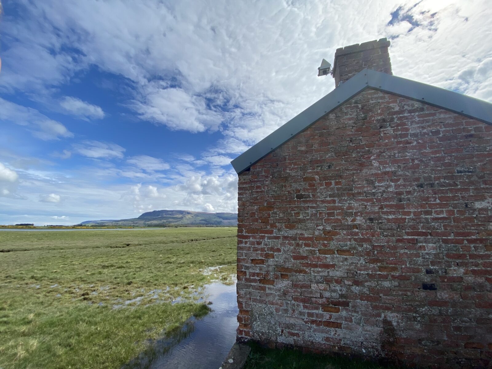
Last week the first camera was installed at the Northern Ireland Environment Agency site at the Roe Estuary Nature Reserve and will continually monitor the habitat, wildlife, tides, and weather patterns across the saltmarsh. This will be the first time that this type of technology has been used by a Landscape Partnership in Northern Ireland, and it will generate a unique digital archive of the natural environment for public engagement both at a local, regional, and international level. Researchers at Queens University will also use automated ‘Machine Learning’ and Artificial Intelligence (AI) techniques to ‘count’ bird life in the images and map any changes in the Saltmarsh tidal channels and the other camera locations.
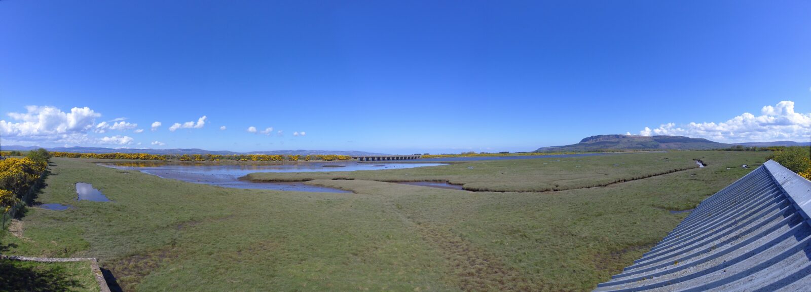 The technology works by the camera capturing two high resolution stereo images at regular intervals (less than 10 minutes) which are then automatically stitched together to create time-lapse videos, panoramic views and immersive images that can be viewed online and freely downloaded. A simple mobile phone data sim in the camera ensures that images are regularly uploaded for public viewing and project archive. The cameras are powered by renewable solar energy over the spring and summer and a small wind turbine in the winter months.
A second camera will be installed at Magilligan point to monitor tides, dune movement and erosion, and a third on Altikeeragh Bog, an area which will undergo restoration as part of the landscape partnership ‘rewetting’ project. The camera will record the change in hydrology and vegetation as drainage ditches are blocked, and self-seeded conifers removed. The camera will record wildlife activity as well as local climate data over the lifetime of the project.
Images and videos from all the cameras are broadcast in near real time, will be publicly available and free to download online, and it is hoped that they will be used by other organisations for climate and habitat change research purposes, as well as having have both educational and tourism added value allowing live ‘virtual’ access to locations that may be difficult to physically access by the public.
It is also hoped that the camera system will give a unique view and future community archive of the landscape over a year covering all seasons and environmental range/conditions, ultimately connecting people with the landscape.
‘It is really exciting to be involved in this project to monitor, help landscape managers and local communities to protect these important habitats and landscapes. Researchers and Students at Queens University Belfast and further afield will use the images from the sites to record habitat and landscape change over time, and improve our understanding of the effect of our changing climate on these sensitive coastal and upland areas.
Conor Graham (Queens University Belfast)
Images and videos can be viewed HERE
This project is funded by the National Lottery Heritage Fund and the Northern Ireland Environment Agency.