

- This event has passed.
Mapping Monuments Conference
November 17, 2023 @ 9:00 am - 5:00 pm
Explore the local legacy of the Ordnance Survey around Lough Foyle.
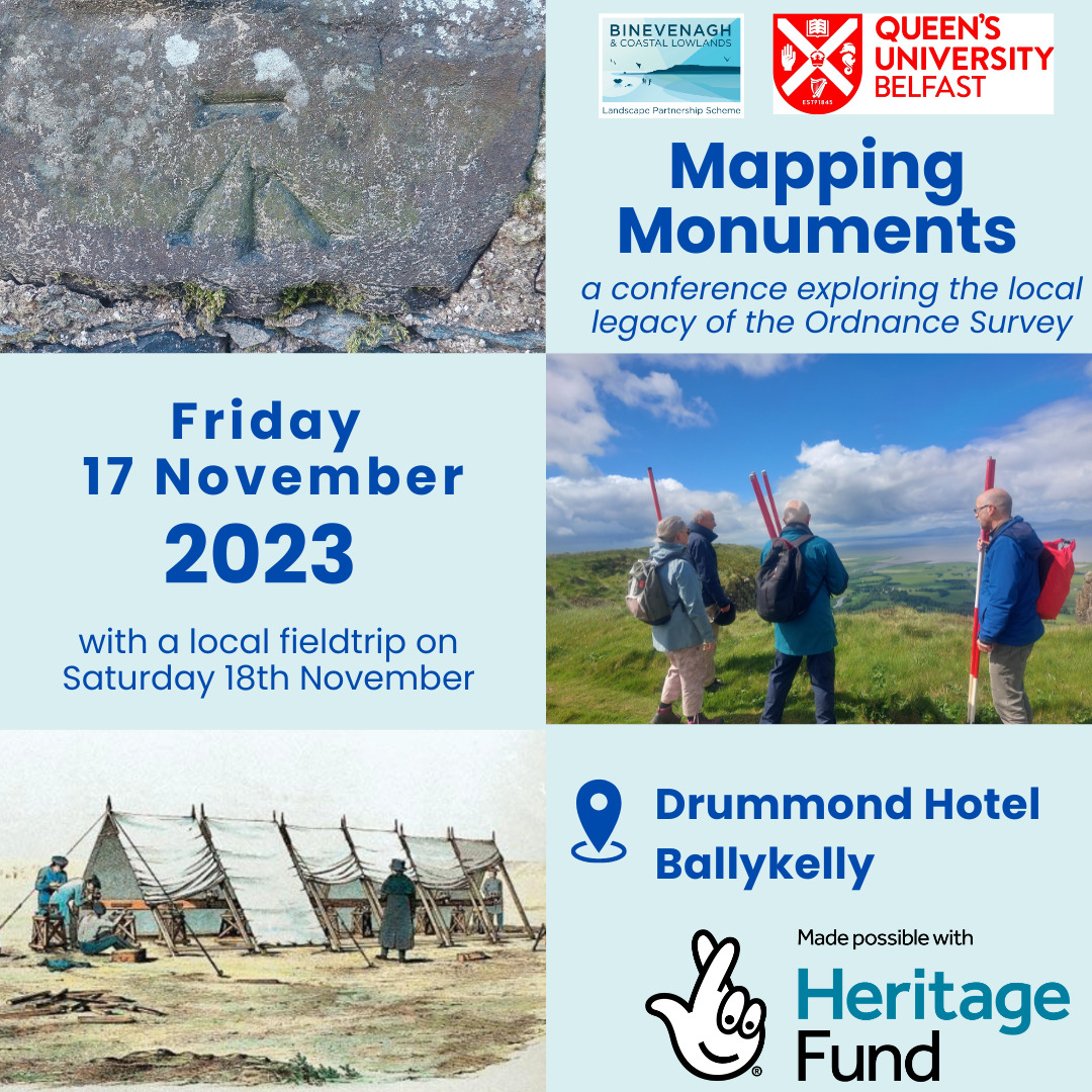
Friday 17th November one-day public conference.
The conference organised by the Binevenagh & Coastal Lowlands Landscape Partnership & Queens University Belfast will celebrate the end of the ‘Mapping Monuments’ community heritage project funded by the National Lottery Heritage Fund.
Since November 2021, volunteers have been working on the Mapping Monuments project, carrying out fieldwork and local research to find traces of the Ordnance Survey in the landscape. The conference will explore the project’s findings, as well as see the launch of a new travelling exhibition about the Lough Foyle Baseline and its heritage.
The conference will be opened by Joe Mahon and the day will be filled with hugely knowledgeable speakers – both academics and volunteers who have been working on the project.
The conference will cost £10 and will take place at the Drummond Hotel, Ballykelly, a light lunch will be provided.
There will also be a local field trip on Saturday 18th November to visit sites studied during the Mapping Monuments project. Full programme details will be announced shortly.
To register for the conference please click on this link http://bit.ly/OS_conference
Contact grace@ccght.org if you have any questions.
#nationallotteryheritagefund #causewaycoastandglensheritagetrust #AONB #ordnacesurvey #heritageisopen #heritage
FULL AGENDA
09.00 Registration and coffee
09.45 Welcome and introduction, Grace McAlister and Keith Lilley
Orientations — Opening-up the map
10.00: Joe Mahon, ‘John O’Donovan and Me’
10.15: Finnian O’Cionnaith, ‘“A peculiar survey… for our peculiar purpose”: founding the
Ordnance Survey of Ireland’
10.45: TEA BREAK
SESSION 1 — Exploring the Ordnance Survey in the landscape
11.00: Zenobie Garrett, ‘OS200–Establishing a (data)base line for the Ordnance Survey in
19th-Century Ireland’
11.25: Mick Cory, ‘From limelight to satellite: the importance of the Lough Foyle Baseline’
11.50: Discussion / Q&A
12.00: Peter Wilson, ‘Crow’s feet and flush brackets – a legacy of the Ordnance Survey hiding
in plain sight’
12.25: Bridgeen Rutherford, ‘Looking through the archives – life along the line’
12.50: Discussion / Q&A
13.00 LUNCH
SESSION 2 — Creative responses to Ordnance Survey landscapes
14.00: Karen Rann, ‘Drawing relief in Donegal: how hill-sketchers introduced contouring to the
Ordnance Survey’
14.25: Mhairi Sutherland, ‘The Lost Tower and The Light: creative research through
photography, landscape and archive of the original Ordnance Survey of Ireland’
14.50: Discussion / Q&A
15.00: Frances Kane, ‘Revisiting the field: OS stories from the sources in County Fermanagh’
15.25: Paul Murphy, ‘“We must never cease renewing those images”: reimagining Brian Friel’s
legacy for the digital generation’
15.50: Discussion / Q&A
16:00: CLOSING REMARKS

