
A new free exhibition ‘Mapping Monuments’ has opened in Roe Valley Arts and Cultural Centre in Limavady.
The exhibition which explores local Ordnance Survey heritage by looking at traces, sites and stories along the Lough Foyle Baseline is an output of the Mapping Monuments project generously funded by the National Lottery Heritage Fund and Queen’s University Belfast. It was produced in collaboration with local volunteers, Queen’s University Belfast and Binevenagh and Coastal Lowlands Landscape Partnership Scheme.
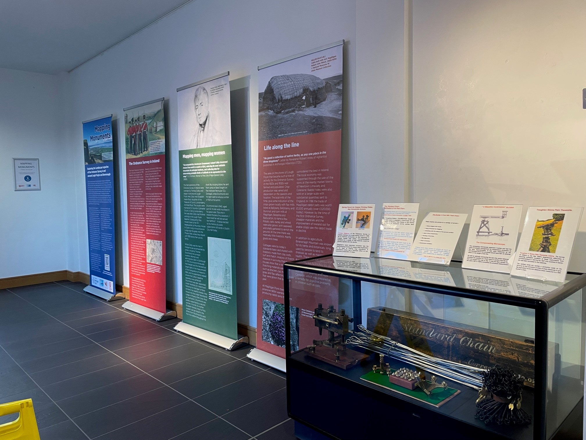
In the late 1820s and 1830s, the countryside around Lough Foyle was busy with surveyors occupied with measuring and mapping landscapes for the Ordnance Survey. It was the world’s first large scale mapping of an entire country, and to complete the work surveyors used chains, theodolites and limelight to calculate distances and heights across the landscape.
Since November 2021, a group of 20 volunteers have been involved in the Mapping Monuments project, carrying out fieldwork and local research to find traces of the Ordnance Survey in the Lough Foyle landscape. This included creating an inventory of local benchmarks on buildings, walls and bridges, archival research and for the first-time geophysical survey of one of the surveyors’ encampment sites at Bellarena Estate.
Speaking at the exhibition launch on Thursday 7th March, The Chief Executive Officer of Causeway Coast and Glens Heritage Trust, Graham Thompson said: “I’m delighted to officially open this wonderful exhibition which raises awareness of survey heritage in the Binevenagh area and acknowledges its international legacy. This exhibition is a testament to the contribution of the volunteers who participated so enthusiastically on the project and shared with us their breadth of knowledge”.
At the exhibition launch, project lead Professor Keith Lilley gave a presentation sharing the project background sharing the project background and findings. Professor Keith Lilley, Queens University Belfast said: “Mapping Monuments’ has truly opened ‘up the map’, revealing the landscape legacies and traces of the activities of the Ordnance Survey in and around the coastal lowlands of Lough Foyle and Binevenagh. The project has been a huge success thanks to the sterling efforts of our group of volunteers, whose research has really helped put the Lough Foyle baseline and its heritage more firmly ‘on the map”.
As well as traditional information boards, the exhibition also includes a book and short film entitled ‘BASE’ produced by Dr Mhairi Sutherland (‘Mapping Monuments’ artist in residence) who was inspired by the legacy of the Ordnance Survey in the landscape. Visitors will also see a collection of surveying instruments and documents on display dating from the 19th century through to the 1980s which chart the progression of survey technology over the years. These items were generously loaned by Dublin based surveyor John Bradley.
Grace McAlister, Project Officer with the Causeway Coast and Glens Heritage Trust, added: “After a very successful and well attended conference on Ordnance Survey heritage back November 2023 in the Drummond Hotel, Ballykelly it’s fantastic to have the accompanying exhibition on display here in Limavady. Ordnance Survey heritage interests a wide range for people, from hillwalkers to historians and we are thankful to Causeway Coast and Glens Borough Council Museum Service and Roe Valley Arts and Cultural Centre for facilitating the use of their exhibition space and enabling us to share the project even more widely”.
‘Mapping Monuments’ will run from Thursday 7th March until Saturday 29th June. It will then be on display in Armagh County Museum during July and August.
* Please note that due to another event in Roe Valley Arts and Cultural Centre, the exhibition will not be publicly accessible on 12th and 13th March 2024*


