
Water Quality, Flora & Fauna to Flourish at Altikeeragh ASSI Bog
The Binevenagh & Coastal Lowlands landscape Partnership Scheme is beginning a programme of restoration work on the peatland located at Altikeeragh Area of Special Scientific Interest (ASSI) in the uplands above Castlerock and Articlave. Altikeeragh Bog is an area of largely intact blanket bog which is owned and managed by NIEA. The site was designated as an ASSI because of its peatland flora and associated fauna.
The aim of peatland restoration is to enable Altikeeragh to resume the functions of a healthy bog ecosystem which can improve water quality, act as a carbon sink and help mitigate against extreme flood events. The Peatland restoration works will begin this Autumn (September 2023) and will last approximately 5 weeks depending on the weather conditions. Restoration works will include the creation of approximately 200 peat dams and remedial repairs to the existing plastic dams which were installed c. 20 years ago.
The restoration works will be carried out by Martins Contracting Ltd. Alex Houston from Martins Contracting Ltd. said “Martin are very excited to partner with the Binevenagh Landscape Partnership Scheme to rehabilitate the raised Peatbogs along the north coast. Having developed our expertise across many ecologically sensitive sites throughout Northern Ireland, we are currently bidding on similar projects across the UK and Ireland. We take huge pride in our contribution to lower carbon emissions and reinstate the natural habitat to what it once was”.
Upland water management is a hot topic in the north-west of Northern Ireland following the dramatic floods of August 2017 which resulted in damage costing hundreds of millions of pounds. These extreme weather events are occurring with an ever-increasing frequency and much of this change has been attributed to climate change. For generations, the uplands of the Binevenagh & Coastal Lowlands LPS area have been continually drained, cut, burned, fertilised and heavily grazed to ‘improve’ the land to make it better grazing land. Drainage is often the key damaging factor in that the aim is to discharge the water from the land as quickly as possible and in prolonged heavy rainfall events, this can lead to flooding.
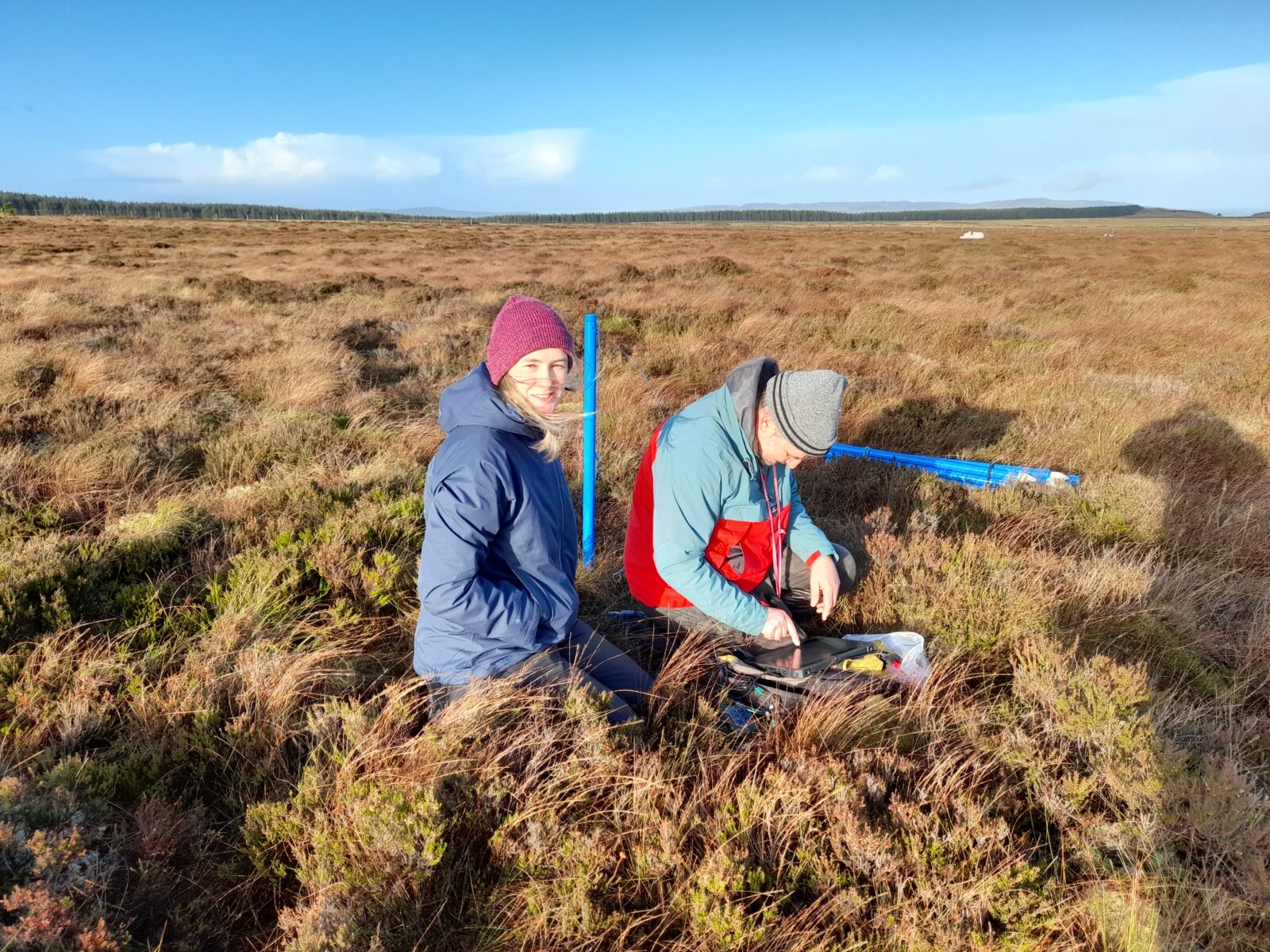
This project aims to restore the water retention capabilities of the upland bogs of the area and improve the bog’s ability to sequester carbon and bring about biodiversity improvements. To restore these areas, some of the most damaging drains will be blocked by creating peat dams which will raise the water table and allow the habitats behind the dam to recover. Bogs are complex hydrological systems, therefore detailed monitoring and surveys have been conducted over two years by Dr Ray Flynn from Queens University Belfast. The results have enabled the development of a peatland restoration plan that is tailored specifically to the site.
The Binevenagh and Coastal Lowlands Natural Heritage Project Officer, Laura McAuley says “Altikeeragh Bog is a very special site, not only for its ability to store carbon and help prevent climate change, reduce flood risk and improve water quality, but also for its ability to provide habitat to many priority species of upland birds such as snipe, red grouse and kestrel. By carrying out these restoration works on the bog we are breathing new life into a once well-established bog which flourished with sphagnum mosses and priority bird species. We hope that by engaging the local communities we can raise awareness of the importance of water quality in relation to our local peatlands and help people understand why improving our peatlands is so important for future generations”.
Contact Laura McAuley laura@ccght.org for more information on the project or to learn about getting involved in future activities or visit Binevenagh & Coastal Lowlands Landscape Partnership scheme Facebook page
Photo 1 – Ray Flynn Hydrologist from Queens University carrying out hydrological monitoring on Altikeeragh Bog
Photo 1 – Ulster Wildlife Youth Residential group marking out peat dam creation locations using GIS mapping techniques
Photo 3 – Weather monitoring station at Altikeeragh Bog


